Table of Contents
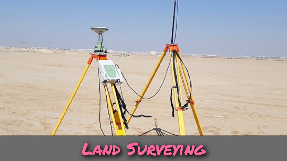
Land Surveying Definition
Land surveying is a discipline that encompasses a range of techniques, professions, and scientific principles used to accurately determine the positions of terrestrial or three-dimensional points, as well as the distances and angles between them.
This field is commonly practiced by licensed surveyors and professionals in various construction-related industries. The points being surveyed are typically located on the Earth’s surface, and the information obtained through land surveying serves various purposes.
What Is Land Survey?
A crucial application of land surveying is the establishment of land maps and boundaries for legal and ownership purposes.
Surveyors play a vital role in determining property boundaries, marking the corners of land parcels, and creating accurate maps that depict these boundaries.
This information is essential for activities such as property sales, land development, and compliance with government regulations.
Land surveying involves a comprehensive and meticulous examination of a specific area.
Surveyors gather information through various means, including on-site observations, precise field measurements using specialized tools and equipment such as theodolites, total stations, and GPS receivers, conducting questionnaires or interviews, and researching legal documents related to the land in question.
The collected data is then carefully analyzed and interpreted to facilitate planning, design, and the establishment of property boundaries.
Proficiency in various techniques and technologies is required for the practice of land surveying. Surveyors utilize instruments like theodolites, total stations, and GPS receivers to accurately measure angles, distances, and elevations. These tools enable them to establish control points, delineate boundaries, and create reliable maps.
Land surveying may also include geodetic surveys, which focus on determining precise positions on the Earth’s surface over large areas. Geodetic surveys often serve as a foundation for mapping and other surveying activities.
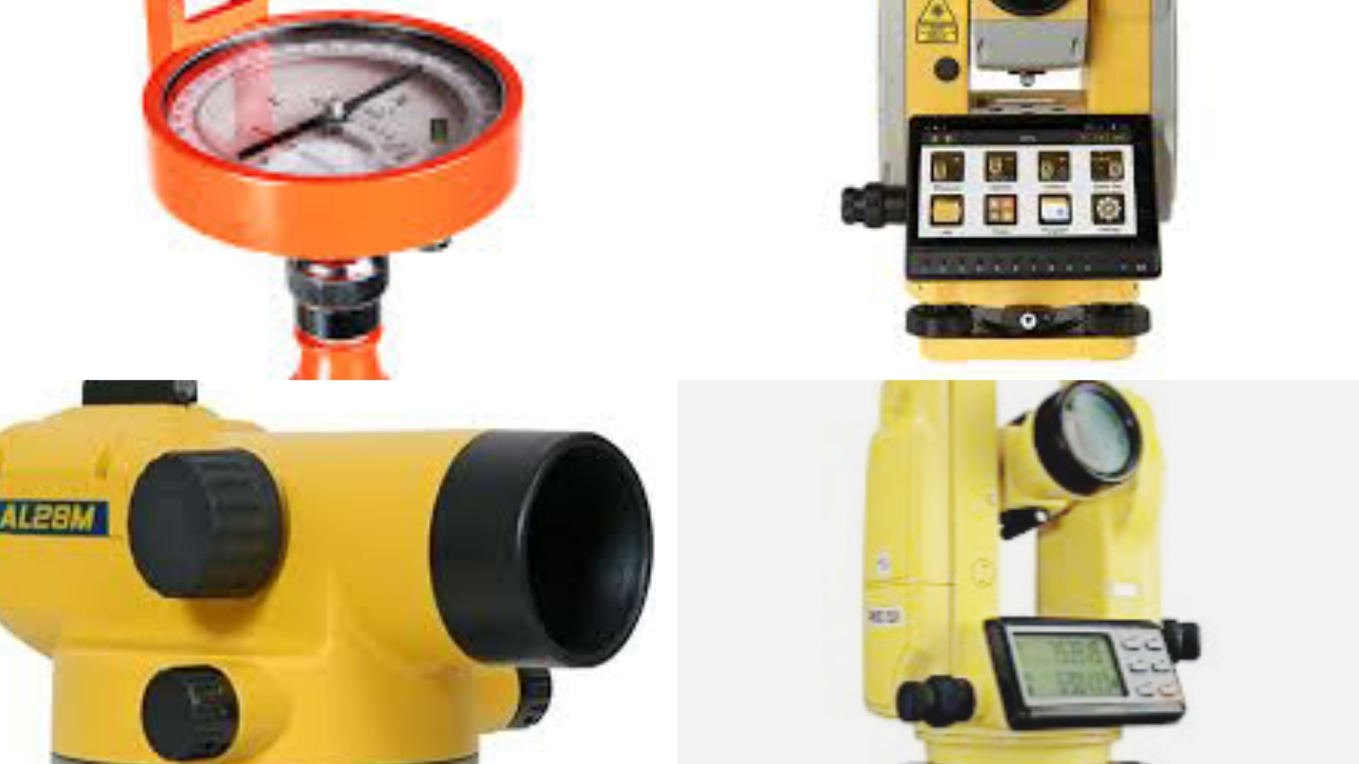
Instruments Used In Land Surveying
- Theodolite
- Automatic level or dumpy lever
- Total Station
- Survey Compass
- Tripod
- Measuring tapes
- Plumb bob, arrows, staff, ranging rods, and other miscellaneous tools.
- Plane Table
Software For Land Surveying
Land surveyors, construction professionals, and civil engineers rely on various tools such as total station, GPS, 3D scanners, and other data collectors to gather information. To enhance their efficiency, accuracy, and productivity, these professionals utilize Land Surveying Software, which has become an essential component of modern land surveying practices.
In contemporary land surveying, the surveyor typically undertakes much, if not all, of the drafting work and some aspects of designing plans and plats for the surveyed property. The use of computer-aided design (CAD) software and hardware has become commonplace among drafting professionals. This trend extends to newer generation data collectors used in the field.
In addition to CAD software and hardware, surveyors also make use of various computer platforms and tools provided by governmental survey agencies such as the U.S. Federal Government, the National Geodetic Survey, and the CORS network. These platforms offer online resources that enable automated corrections and conversions for GPS data collected during surveys. They also provide access to data coordinate systems.
By leveraging these advanced technologies and software solutions, land surveyors can streamline their workflows, improve the accuracy of their measurements, and increase overall productivity. These tools have become indispensable for professionals in the field, allowing them to deliver high-quality surveying services in a timely manner.
How To Conduct Land Survey
Here is the step by step procedure of land surveying.
1. Initial Data Collection:
The first step in land surveying involves gathering available data pertaining to the location that needs to be surveyed. This data can be obtained from various sources such as wills, deeds, contracts, maps, and other relevant documents. By examining this information, surveyors can gain an understanding of the land’s boundaries and other relevant details.
2. Field Examination:
Once the necessary data has been collected, a physical examination of the site is conducted to identify the actual physical evidence of the land’s boundaries. This involves visiting the location and locating and setting up a monument. A monument is an identifiable object or marker that is permanently placed at a specific location in the field.
3. Preliminary Investigation:
Before proceeding with the detailed surveying process, a preliminary investigation of the field is carried out. This phase, known as reconnaissance, involves studying the site and its surroundings to gain a comprehensive understanding of the terrain, existing features, and any potential challenges that may affect the surveying process.
4. Positional Determination:
Once the preliminary investigation is completed, appropriate instruments and methods are employed to determine the positions of various points on the land. This typically involves using techniques such as traversing and detailing to establish accurate measurements and reference points.
Techniques Used In Land Surveying
1. Global Positioning System (GPS):
GPS is widely used in land surveying to determine precise positions on the Earth’s surface. It relies on a network of satellites to provide accurate three-dimensional coordinates, allowing surveyors to establish control points and measure distances and angles with high precision.
2. Total Station:
A total station is an electronic instrument that combines electronic theodolite (measures angles) and electronic distance measurement (measures distances) capabilities. It can be used to measure angles, distances, and elevations of various points on the ground.
3. Theodolite:
A theodolite is an optical instrument used to measure vertical and horizontal angles. It consists of a telescope mounted on a rotating base and is primarily used for angular measurements in land surveying.
4. Leveling:
Leveling is a technique used to determine the relative heights or elevations of points on the ground. It involves the use of a leveling instrument, such as a level or an automatic level, to measure the vertical differences between points.
5. Electronic Distance Measurement (EDM):
EDM instruments use electromagnetic waves, such as infrared or laser beams, to measure distances accurately. They are often integrated into total stations or used as standalone devices for distance measurements.
6. Remote Sensing:
Remote sensing involves collecting data about the Earth’s surface from a distance, typically using aerial photography, satellite imagery, or LiDAR (Light Detection and Ranging) technology. These techniques provide detailed information about the terrain and can be used to create digital elevation models and orthophotos.
7. Geographic Information System (GIS):
GIS is a computer-based system used to capture, store, analyze, and present spatial data. It is commonly used in land surveying to manage and integrate survey data, create maps, perform spatial analysis, and generate reports.
8. Photogrammetry:
Photogrammetry uses photographs taken from different angles to measure distances, elevations, and three-dimensional characteristics of objects or terrain. It can be employed in land surveying to create accurate maps and digital models.
9. Field Observation and Data Collection:
Surveyors also rely on manual field observation techniques to collect data, such as measuring tapes, ranging poles, compasses, and clinometers. These tools are used for measurements, marking points, and recording field notes.
10. Land Records and Legal Documentation:
Surveyors often conduct research in land records, historical maps, and legal documents to gather information about boundaries, property lines, and previous surveys. This information helps in establishing accurate survey control and resolving boundary disputes.
Uses Of Land Surveying
The primary uses of land surveying are described as follows:
- Identification and positioning of different natural and man-made elements on the Earth’s surface.
- Accurate determination of global coordinates for specific locations worldwide.
- Creation of topographic maps that exhibit a high level of precision and detail.
- Establishment of boundary lines to define ownership boundaries, international borders, and other relevant demarcations.
- Assessment of easements, encroachments, and land development activities.