Table of Contents
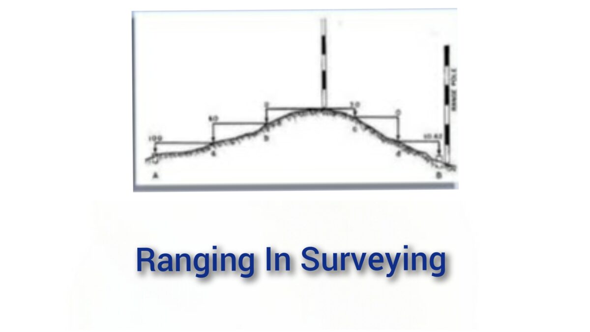
Ranging In Surveying
Ranging in surveying involves measuring the distance between two points or objects in the field. Ranging is necessary when a survey line is longer than a chain length, as it is important to align intermediate points on the chain line so that measurements are accurately taken along the line.
There are two main methods of ranging: direct ranging and reciprocal ranging. Reciprocal ranging also called as indirect ranging.
Direct ranging involves measuring the distance from one point to another in a straight line, while reciprocal ranging involves measuring the distance from both points in opposite directions and averaging the results.
Each method has its own advantages and disadvantages, and the choice of method will depend on the specific needs of the surveyor and the terrain being surveyed.
Types Of Ranging
We will discuss both ranging methods in detail.
1. Direct Ranging
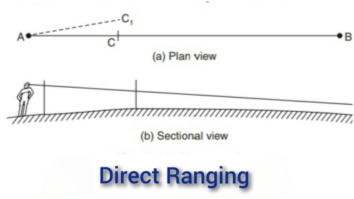
This method is applied in case of first and last points are intervisible. You can see Points A and B in the figure as mentioned above. In this image, the intervisible
stations A and B in which an intermediate point C is to be located.
Point C is selected at a distance
slightly less than a chain length. Ranging rods are fixed at point A and point B.
A worker holds another
ranging rod near C point. Surveyor positions himself approximately 2 m behind station A and looking along
line AB directs the assistant to move at right angles to the line AB till he aligns the ranging rod along
AB. Then surveyor instructs the worker to mark that point and stretch the chain along AC.
2. Indirect Ranging
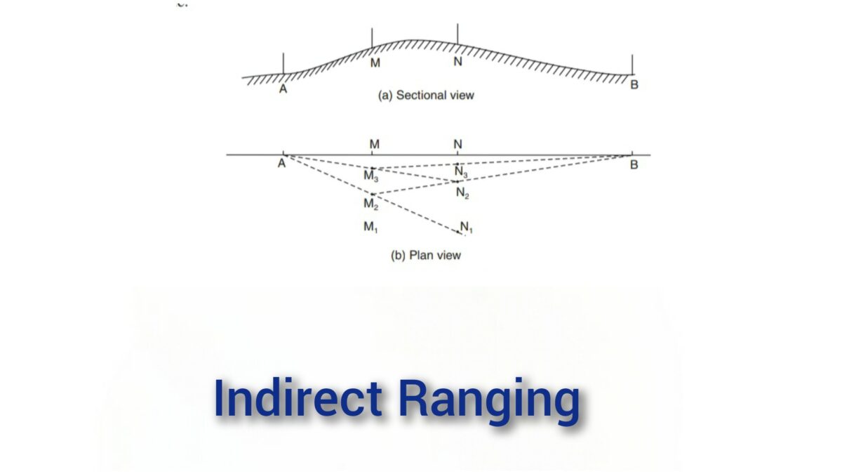
Indirect ranging method is used if the ranging rod at B is not visible from station A . See the arrangement in the above figure.
Indirect ranging method required 2 workers. One worker at point M and another worker at point N, where from those points both station A and station B are visible.
It required one surveyor at A point and another at B point. To start with M and N are approximately selected, say M1 and N1.
Now, surveyor near end A ranges person near M to position M2 such that AM2N1 are in a line. Then surveyor at B directs person at N, to move to N2 such that BN2M2 are in a line. The process is repeated till AMNB are in a line.