Table of Contents
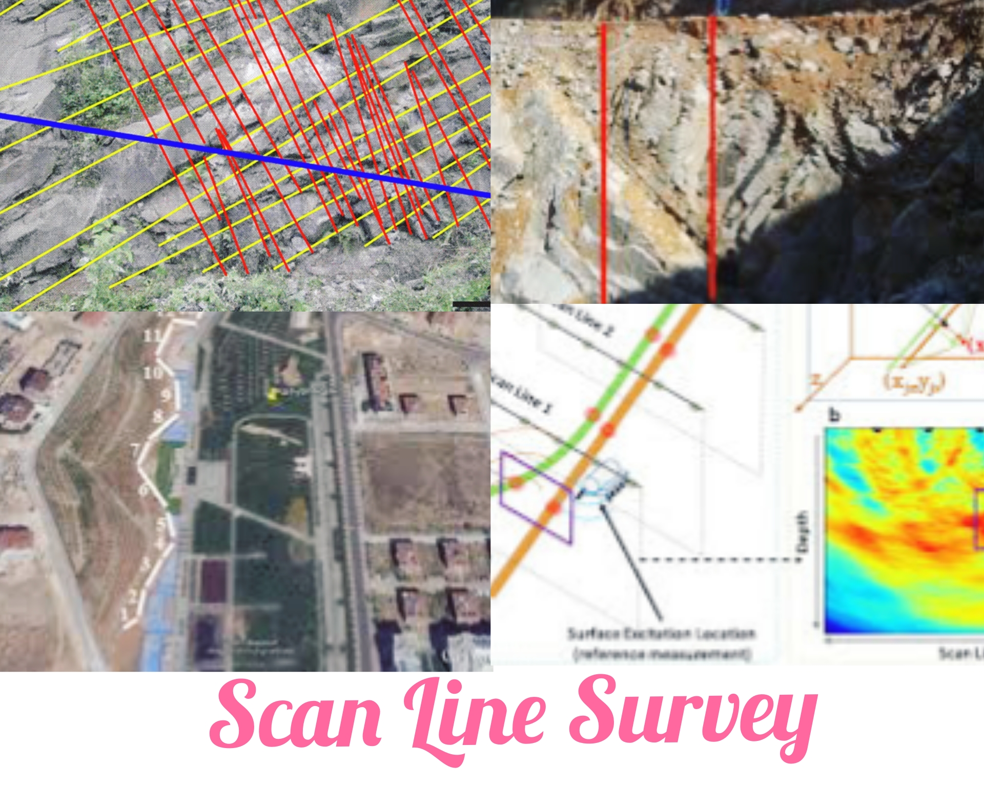
What Is Scan Line Survey?
Scan line survey is used to determine the quality of rock mass and underground structures. Scan line survey also called as discontinuity survey.
In this type of survey, the outcropped rock surface is scanned, and data is collected for rock mass analysis, contributing to the preliminary design of structures supported on rocks.
During this process, surveying involves drawing a horizontal line across the surface of the exposed rock and examining properties such as spacing, orientation, firmness, and porosity of dissection. All identified properties are then entered into the scan line survey datasheet.
Scan line survey is a comprehensive analysis of the collected data determines the strength, deformability, and flow characteristics of the rock mass. By quantifying the information gathered from the entire exposed surface, a valuable database is created, facilitating informed decision-making in engineering design projects for that specific site.
Features
Here are some key features of scan line survey.
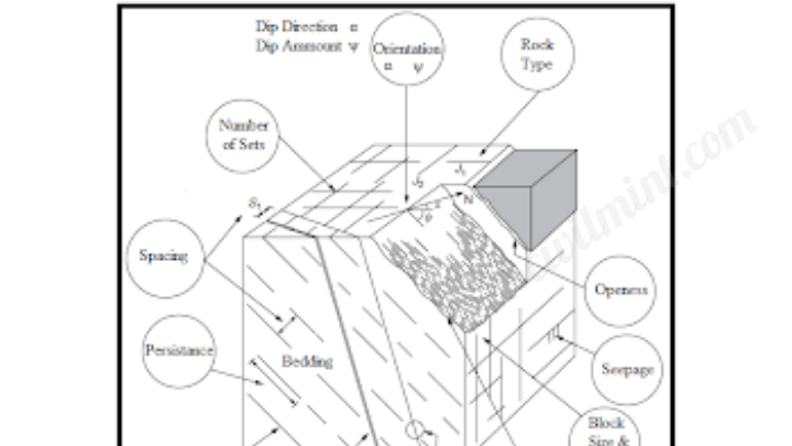
1. Orientation
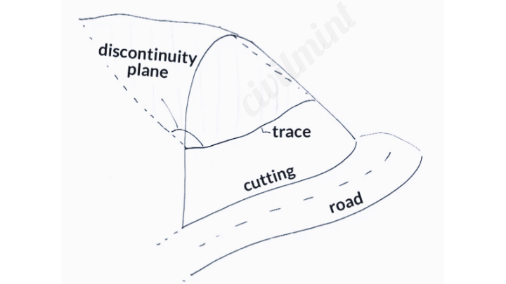
The orientation of a discontinuity is its direction & dip. Orientation & dip can be measured easily by using a compass and clinometer.
See the below figure.
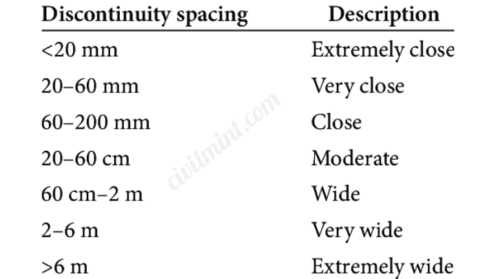
2. Spacing
It is the average distannce between various discontinuities. This can be determined by counting the number of discontinuities intersecting the scan line and dividing by the length of the line.
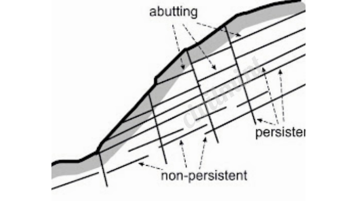
3. Persistence:
The duration of a gap’s interruption is determined by the length of its visible mark on the rock surface. This measurement can be obtained by tracking the gap’s mark along the rock’s exterior.
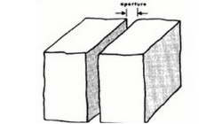
4. Aperture:
The measurement of the width of an opening in a discontinuity is referred to as the aperture. This can be determined using a caliper.
5. Filling
The process of filling a discontinuity involves introducing material to occupy its void. This material can consist of intact rock, soil, or a mixture of both.
Advantages Of Scan Line Survey
- Scan Line Survey enables surveyors to cover large areas quickly, facilitating efficient data collection.
- It enhances the reliability of survey results by providing accurate and precise measurements.
- The method reduces errors and omissions through a systematic and organized approach to data acquisition.
- Scan Line Survey adapts to various terrain types, making it suitable for both land and underwater environments.
- It creates detailed and comprehensive visual representations of surveyed areas.
- This technique allows for monitoring changes over time, such as in environmental studies or construction projects.
- Scan Line Survey minimizes disruption to the surveyed area as it is less intrusive compared to other survey methods.
- It enables real-time data acquisition, allowing for on-site analysis and adjustments as needed.
- The method improves the overall survey quality by capturing complex and irregularly shaped features.
- Scan Line Survey enhances the level of detail and accuracy achieved during the survey process by being compatible with advanced technologies like LiDAR.
Conclusion
The data obtained from a scan line survey plays a crucial role in evaluating the quality of the rock mass. This information is essential for designing structures that prioritize safety and stability.
I recommend you to read my article on Ranging In Surveying.
For instance, when a scan line survey reveals significant fractures in the rock mass, engineers and geologists must ensure the structures built on it are robust enough to withstand such conditions.
You Might Also Like: Errors In Chain Surveying
Scan line surveys have become an invaluable tool for professionals working with rock, offering a reliable and efficient means to gather essential data on rock discontinuities. This data aids in assessing the rock mass quality and guides the design of secure and stable structures, making it an indispensable practice in the field.