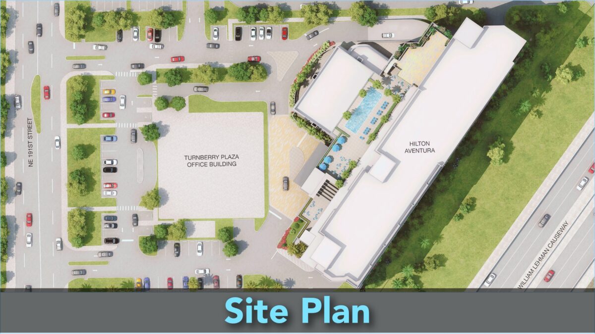
A Site Plan is a document that shows a bird’s-eye view of a property. It is drawn to scale and shows where buildings, landscaping, and other things are on the land. The document needs to be accurate and easy to understand, so the scale used depends on the size and complexity of the property.

To make a Site Plan, you need to show the property’s size, where the buildings are, where the property lines are, and any other important things on the land. You also need to follow local rules and show natural features like hills or trees, and man-made things like roads or walkways.
Site Plans are important for building or outdoor projects because they give a good understanding of the property, and help to make sure the project is successful.
Table of Contents
What Is A Site Plan?
A site plan is a crucial large-scale drawing that provides an overview of a construction site’s extent, whether it involves erecting new structures or enhancing existing ones. This symbolic representation outlines the building’s layout and its associated utilities, allowing stakeholders to visualize the structure’s location on the site.
The site plan includes important information, such as property lines, existing boundaries, and site access, as well as any neighboring buildings or structures that may affect the design. The top-down view of the property is drawn to scale, making it easier for stakeholders to understand the spatial relationships between the different elements.
It is essential that the site plan clearly depicts the existing utilities and connections, such as water supply lines, drainage lines, sewer lines, electrical lines, communication cables, and underground cables. This is critical for planning, developing, and improving the site or property.
It is important to ensure that the site plan complies with existing bylaws and local development codes. This is because the site plan serves as a legal agreement for obtaining permission from the relevant authorities to proceed with construction.
Site Plan Scale
When undertaking construction projects, site plans are essential. They provide detailed information about the construction site, including the location, size, and layout of proposed structures. Site plans typically consist of a two-dimensional drawing that depicts the elements of the site, which may include boundaries, structures, roads, parking areas, and more.
The first step in preparing a site plan is to choose an appropriate scale. The scale chosen depends on the size of the project. In most cases, site plans are drawn to a scale ranging from 1:500 to 1:200. For larger projects, a smaller scale may be used, while smaller projects require larger scales. The chosen scale should allow all the essential information to be depicted in a clear and readable manner.
Elements Included in a Site Plan
The site plan should depict all the essential elements of the construction site. These typically include property lines and boundaries, proposed and existing structures with clear outlines, distances between proposed structures and nearby structures, setbacks indicating the distance between the proposed structure and the property line, parking spaces, driveways, parking lots, nearby streets, roads, existing utility and service lines.
Information Required in a Site Plan
Several pieces of information must be included in a site plan. Firstly, the title block should contain the project name, type of drawing, the name of the plan preparer, project status, revision number, and the drawing scale. Revisions should be noted and highlighted, indicating any changes made. A north-pointing arrow indicating the directional orientation should also be shown, as well as the dimensions of the drawing. Additionally, the primary materials used in the construction should be specified, along with property lines, boundaries, adjoining streets, and properties. The location of the proposed construction within the surrounding area, existing trees, plants, and other ecologically important elements, or restricted spaces, such as public plantations, should be indicated. Parking spaces’ clear dimensions, traffic flow, and relevant signs should be specified, as well as existing streets, roads, pavements, and easements, such as the right of way and right of support.
For more complex projects, additional information may be necessary. This information can include any existing property or building that requires demolition, the layout of the existing utility lines and service lines, such as drainage lines, sewer lines, electricity cables, etc. The extent of excavation and earthworks necessary, including the cutting and filling, must also be specified. Fences, gates, walls, and other external features, such as fire hydrants and municipal litter bins, if any, should also be included in the site plan.
Sum Up
Site plans are an essential tool in construction projects, providing detailed information about the construction site. A clear and accurate site plan is necessary to ensure the success of any construction project.
