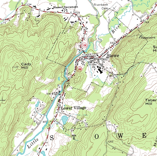
A topographic survey finds all features of a property’s surface and delineates all-natural features and heights. Essentially a 3D map of 3D properties showing all-natural and man-made features and improvements. Specifically, it shows position, size, height, and height changes.

A topographic survey is usually based on systematic observations and is published as a series of maps made up of two or more map sheets that together form an overall map. The set of topographic maps uses a common specification that includes a number of cartographic symbols used, as well as standard geodetic structures that define map projections, coordinate systems, ellipsoids, and geodetic reference systems. Official topographic maps also use the national grid system.
These maps detail topography (reliefs and terrain), watersheds (lakes and streams), forest cover, administrative divisions, settlements, transport routes and structures (including roads and railroads), and other man-made objects.
The study or field of the terrain is a much broader field of study that takes into account all the natural and man-made features of an area. Maps were one of the first artifacts to document observations of the terrain.
Uses of Topographic Survey
Currently, topographic maps are used for a variety of purposes. any type of geographic plan or large-scale construction; earth science and many other fields of geography; mining and other surface work; Civil engineering and recreational uses such as hiking and orienteering.
